Eastport / Passamaquoddy Bay is a far-downeast Maine fishery shaped by strong tidal exchange along rocky shoreline and passages. Atlantic mackerel and pollock are the principal shore targets.
Current Coastal Rating
Poor · 48
Beta
Conditions are poor, but confidence is reduced because some coastal inputs are partial or prediction-based.
Scores are model-specific and are not directly comparable across water types.
Should I Go?
Trip conditions only. Target-species activity and seasonal fishery patterns are not yet included.
Consider
Trip conditions may be workable, but important cautions or data limitations remain.
Low confidence — Important source checks or coastal inputs were unavailable.
Evaluates trip conditions using weather, tides, currents, waves, daylight, and active alerts.
Recommendation scope
Shore
Boat and kayak conditions are not included in this recommendation.
Strong tidal exchange requires site-specific judgment; not every tide phase is unsafe.
Service Status
Degraded
Recommendation confidence is low while the verdict remains Consider.
Recommended window
Wednesday · 6:00 AM–9:00 AM EDT
Window score
58
Max wind
8 mph
Max gust
12 mph
Daylight
67% of window
Tide state
near high
Current event
Slack in window
Why
Current evidence is event-only and does not quantify the full-window maximum.
Automated species match
Likely targets for this window
Matched to the same safe fishing window used by Should I Go?
Atlantic mackerel
Strong match
In the typical seasonal window
Current pattern aligns
Tide pattern aligns
Common approaches: Pier mackerel and pollock jigs
Common presentations: Diamond-style jig, Compact casting metal, Vertical metal jig
Pollock
Strong match
In the typical seasonal window
Current pattern aligns
Tide pattern aligns
Common approaches: Pier mackerel and pollock jigs
Common presentations: Diamond-style jig, Compact casting metal, Vertical metal jig
Atlantic mackerel and Pollock have similarly strong profile matches for this window. Based on seasonal presence, tide, and current.
This is automated, profile-based guidance—not a guarantee of catch or a statement of fishing regulations.
Current Readings
Updated Oct 20, 2026, 9:21 PM
NOAA Station selected
Source
NOAA CO-OPS
Eastport station
0.4 mi from destination
Water level
13.5 ft MLLW
Updated 9 min ago
Water temperature
52.9°F
Updated 9 min ago
Wind
NW · 7 mph
Updated 9 min ago
Wind gust
13 mph
Updated 9 min ago
Past 7 Days
NOAA Station selected
Water level
Window Oct 13, 2026, 9:21 PM – Oct 20, 2026, 9:21 PM (rolling 168 hours)
Water level over the past 7 days. 1679 observations · from Oct 13, 2026, 9:24 PM · to Oct 20, 2026, 9:12 PM Range 1.3 ft MLLW to 19.8 ft MLLW.
Readings increased over the available period.
1679 observations · from Oct 13, 2026, 9:24 PM · to Oct 20, 2026, 9:12 PM
These values are tidal-current predictions, not real-time observed currents. They describe conditions near this prediction station rather than the entire surrounding coastal area.
Data coverage
This station provides max-current and slack-water events, but not a continuous current-speed timeline.
Tidal-current timing can differ from high and low tide timing.
Fishery Profile
Fishery Overview
Eastport / Passamaquoddy Bay cold-water pier and inshore edges
A far-downeast cold-water fishery around Eastport and Passamaquoddy Bay where accessible shore opportunity emphasizes mackerel and pollock amid strong tidal exchange.
Fishery type
Cold water
Pier
Strong tide
Fishing modes
Shore
Inshore boat
Habitat and structure
Eastport breakwater and town landings · Passamaquoddy Bay edges · Strong tidal channels and passages · Cold-water rocky shoreline
Static seasonal guidance · Last reviewed Jul 21, 2026
Not a live bite forecast.
Fishery Targets
Mackerel and pollock are the accessible targets. Offshore groundfish remain separate boat opportunities.
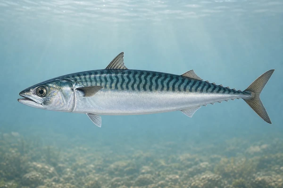
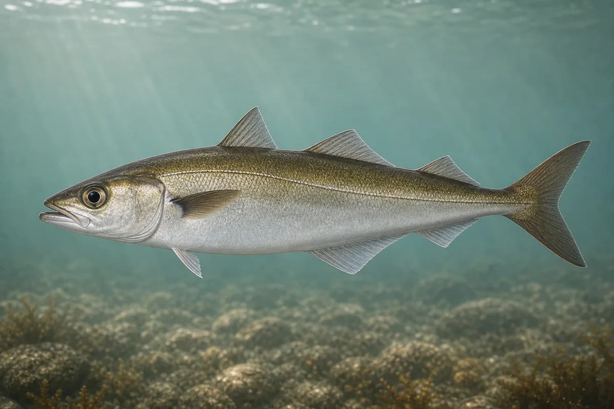
Species images are AI-generated illustrations for visual reference and may simplify natural variation. Fishery records are based on the cited agency and editorial sources. About fish illustrations
Atlantic mackerel
Primary
Scomber scombrus
Currently in a typical seasonal window
Typical seasonal window: JUNE — OCTOBER
Pollock
Primary
Pollachius virens
Currently in a typical seasonal window
Typical seasonal window: MAY — NOVEMBER
Typical Seasonal Targets
Atlantic mackerel — JUNE — OCTOBER
Pollock — MAY — NOVEMBER
Seasonal presence is general guidance and does not indicate current fish activity.
How to Fish Eastport / Passamaquoddy Bay
Typical October approaches include pier mackerel and pollock jigs for Atlantic mackerel and Pollock.
Pier mackerel and pollock jigs
Work compact metals or vertical jigs from public landings when schools and cold-water pollock are available.
Best for
Atlantic mackerel
Pollock
Modes
Shore
Inshore boat
Setup
Cold-water pier metal setup
Common Tackle Setups
Cold-water pier metal setup
Light to medium setup for mackerel and pollock.
Rod
6–8 ft light to medium spinning rod.
Reel
Compact spinning reel.
Main line
Light braid.
Leader
Light abrasion-resistant leader.
Terminal tackle
Compact metals.; Vertical jigs.
Presentation
Fish from secure public footing; strong tidal exchange can change conditions quickly.
Used for
Pier mackerel and pollock jigs
Typical October Lures and Flies
Common lure and fly families associated with this month’s techniques.
Diamond-style jig
Lure
Atlantic mackerel
Pollock
Midwater to variable · Jig, fast, steady
Cast and retrieve with a steady or pulsed cadence through bait schools
Vertical metal jig
Lure
Atlantic mackerel
Pollock
Midwater to bottom · Jig, fast
Maintain contact and vary hop height until fish show a preferred cadence
Compact casting metal
Lure
Atlantic mackerel
Pollock
Shallow to midwater · Fast, steady
Lead showing fish and keep a fast, even retrieve
General seasonal guidance, not a live recommendation, product endorsement, or guarantee of success.
Access, Safety and Regulations
Access
Shore fishing is common at the Eastport Breakwater Boat Ramp area per the Maine DMR guide. Nearby Lubec and Cobscook access also experiences very strong currents.
Primary hazards
Rapid tidal exchange is the defining hazard. Use public access carefully and strong currents are not proof of better fishing.
Fishery considerations
Live tide observations and Friar Roads current predictions help describe exchange. Current values are predictions.
Regulations
Size limits, seasons, and possession rules change. Verify the current official regulations before fishing.
The map marker represents the cataloged waterbody or monitoring location and may not indicate legal parking or public access. Confirm access through the official information before visiting.