
Coastal
How Tides Affect Coastal Fishing
Tides change water height; tidal currents change how water moves. NOAA is the U.S. authority for predictions. Here is what that means for anglers and how StrikeTracks presents coastal tides.
StrikeTracks Editorial Team3 min read
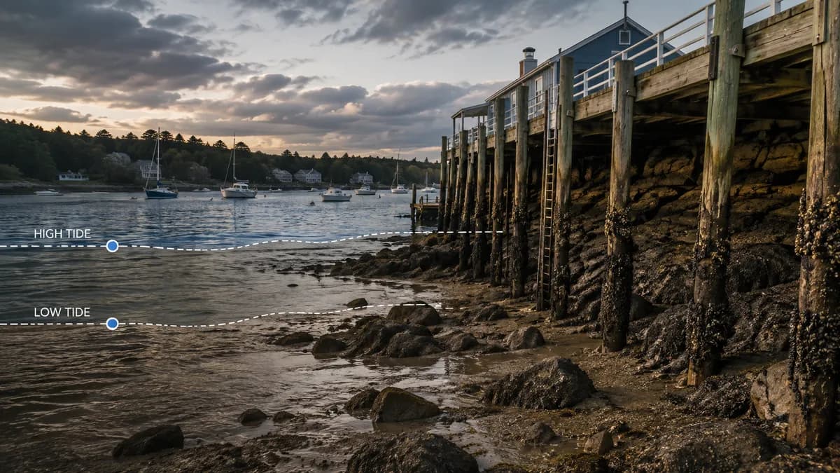
If you fish salt water, tide is often the clock you actually care about. Bait moves. Bars cover or uncover. Current turns on or dies. None of that is folklore in the sense that the ocean does not rise and fall — it does. The mistake is treating one tide rule as if it worked on every coast, inlet, and marsh.
Tides and currents are related, not identical
NOAA describes tides as very long-period waves driven mainly by the gravitational pull of the Moon and Sun. At the coast they appear as the regular rise and fall of the sea surface. Currents are the horizontal movement of water. Tides are one driver of currents; wind, basin shape, and other forces also move water. High tide is a water-level event. Flood and ebb are current events. Slack is a current event. Anglers often say “the tide is moving” when they mean current, and that shorthand hides useful detail.
NOAA’s Center for Operational Oceanographic Products and Services (CO-OPS) is the U.S. source for official tide and tidal-current products. Tide predictions and current predictions are based on observations at specific stations. NOAA is explicit that current predictions do not include wind, weather, or river flow at the surface. A wind-opposing ebb, a storm surge, or a flooded river can make the water behave unlike the astronomical table.
Range is a place, not a personality trait of “the ocean”
How much the water rises and falls depends on where you are and which day it is. A pocket marsh, a steep rocky shore, and a broad sandy inlet do not share one tidal range. Great Lakes water-level variation is a different regime; NOAA notes that astronomical tides there are very small compared with weather and hydrology. Do not copy a New England tide story onto a Gulf lagoon or a Pacific estuary.
What anglers can honestly take from a tide table
- Water-level windows: when a flat, bar, or jetty is covered enough to fish or too high to reach a trough.
- Current windows: when water is exchanging through an inlet, along a point, or out of a marsh — often when bait and predators are moving.
- Access windows: launches, bars, and parking that flood or dry. That is safety and logistics, not a bite forecast.
- Mismatch risk: a predicted slack that is not slack because wind is pushing water, or a high tide that is higher than the table because of setup and surge.
There is no universal “best tide” for fishing
Some fisheries light up on a moving tide. Some fish a high slack in a harbor. Some need enough water on a flat and then a drain. Those patterns are local. StrikeTracks will not invent a national species-by-tide calendar. Where a coastal destination page includes tides or related marine observations, they are destination-configured observations — not a promise that striped bass, redfish, or snook will eat.
Coastal Should I Go and Current Coastal Rating, where published, are decision support under the destination’s accepted method. They are not a tide-bite index, and they are not a statement that Estimated Conditions exist for the coast. Wind is a separate article: Wind and Coastal Fishing.
Use NOAA predictions and StrikeTracks coastal pages together as planning layers. Then look at the actual water. A table cannot see a closed inlet, a debris line, or a thunderstorm coming down the bay.
Related Fishing Insights
- Wind and Coastal Fishing: What Anglers Should Watch
Wind changes waves, boat control, and how water moves near shore. National Weather Service marine products are the place to start — and they are not a fishing-success forecast.
- Tide, Current, and Waves: Three Different Coastal Fishing Signals
Tide is water level. Current is water moving sideways. Waves are mostly wind acting on the surface. Mixing the three into one “the ocean is up” sentence hides the information that actually changes a trip.
- What Makes a Fishing Window “Good”?
A good window is a planning judgment under uncertainty — not a promise that fish will eat. StrikeTracks ratings and Should I Go are decision support built from destination-specific evidence.