
Rivers
How to Read a StrikeTracks River Hydrograph for an Actual Trip
A hydrograph is a history, not a single tick. Using Swift River at West Ware, this article separates latest discharge from trend, and fishing suitability from wading safety.
StrikeTracks Editorial Team2 min read
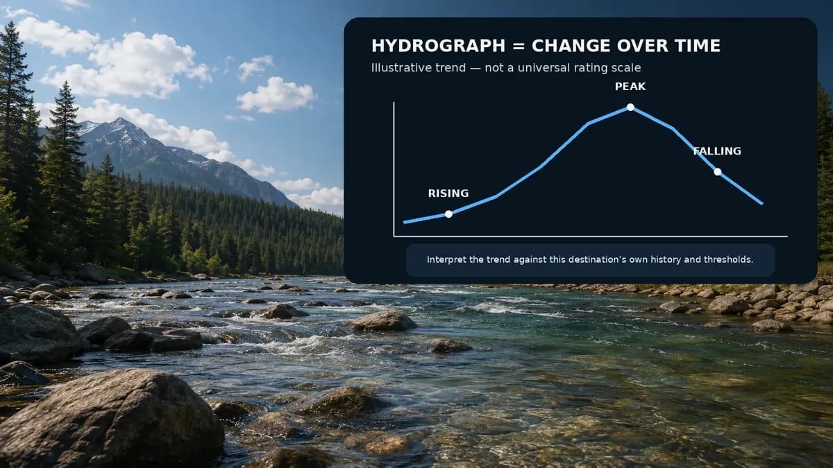
The latest cubic-feet-per-second number on a river page is a snapshot. The hydrograph is the story that snapshot came from. Planning a trip from the tick alone is how people miss a rising storm pulse, a falling generation release, or a multi-day drop that left the channel skinny. This walkthrough uses one real StrikeTracks river. It does not invent today’s trace.
The river and the gage
Swift River at West Ware is a Massachusetts Quabbin-release tailwater. USGS 01175500 sits on that West Ware reach. Open the destination, then open Historical Flow. Beside it, keep the USGS monitoring-location page for 01175500. StrikeTracks is not a raw USGS HTML dump. It is the same public hydrology after a destination contract: this reach, this site, this evidence class.
Current versus trend
Current is the most recent qualifying discharge or stage StrikeTracks is allowed to show. Trend is whether the line is rising, falling, or holding. A value inside the catalog Good band of 30–80 cfs can still be a bad morning if the hydrograph is climbing hard after rain. A value a little above that band can be workable later in a falling series. The product can show the series. It cannot tell you the next hour of dam operations or the cell that has not arrived yet.
- Read the latest tick, then look left. A spike, a stair-step, and a flat line are different trips.
- Treat stage and discharge as related, not interchangeable. Gage height is above a local datum, not the depth at your boots.
- If the series is missing, ice-affected, or stale, believe the gap. Do not interpolate a fishing day from air temperature.
What StrikeTracks can and cannot infer
From a monitoring-backed hydrograph StrikeTracks can support destination-specific flow context: where the recent series sits relative to this reach, and how that feeds fishing-condition guidance. It cannot infer that trout will eat, that a particular pool is wadable, or that tomorrow’s release will match yesterday’s. USGS ratings can be updated when the channel changes. Real-time values are commonly provisional.
Wading is a separate decision. Fishing suitability is not hydrologic safety. The river-page notice is preliminary guidance only: assess weather, access, water depth, current speed, and your own ability before entering the river. Wading Conditions vs. Fishing Conditions is the companion argument. For the instrument itself, use How to Read a USGS Stream Gauge for Fishing.
A trip-sized reading order
Confirm you opened Swift River at West Ware, not another Swift. Note Monitoring-backed Conditions. Read discharge and the hydrograph together. Read what is missing (temperature is not guaranteed). Then read trip guidance as a summary, not as permission. If you need the same-number contrast with a large mainstem, Why Two Rivers With the Same CFS Can Get Different StrikeTracks Guidance is next.
Sources and methodology
These are the primary sources this article actually relies on. Linked agencies do not endorse StrikeTracks conclusions.
- USGS streamgaging basics — USGS explains that streamgages measure stage and that discharge is computed with a site-specific stage-discharge rating, not scooped continuously from the river.
- USGS: why gage height is not the stream bottom — Gage height is the water-surface elevation above a local datum. It is not wading depth at your boots.
- USGS 01175500 — Swift River at West Ware, MA — The monitoring location assigned to StrikeTracks destination Swift River at West Ware. Use the station page for current and historical stage and discharge; this article does not invent a live reading.
- StrikeTracks Research & Methodology — StrikeTracks Historical Flow on a monitoring-backed river is destination-scoped. It does not replace the USGS monitoring-location hydrograph, and it does not certify that wading is safe.
Related Fishing Insights
- How to Read a USGS Stream Gauge for Fishing
USGS streamgages report water level and often compute discharge. Learn what gage height, flow, and temperature mean for trip planning — and what they never tell you by themselves.
- Why Two Rivers With the Same CFS Can Get Different StrikeTracks Guidance
Cubic feet per second is a volume through a channel, not a universal fishing grade. Two real StrikeTracks rivers show why copying a “good CFS” from one water to another is a planning error.
- Wading Conditions vs. Fishing Conditions
A river can fish well and still be a poor idea to wade. StrikeTracks keeps fishing suitability and hydrologic or wading safety as separate questions — and so should you.