
Rivers
Wading Conditions vs. Fishing Conditions
A river can fish well and still be a poor idea to wade. StrikeTracks keeps fishing suitability and hydrologic or wading safety as separate questions — and so should you.
StrikeTracks Editorial TeamUpdated 3 min read
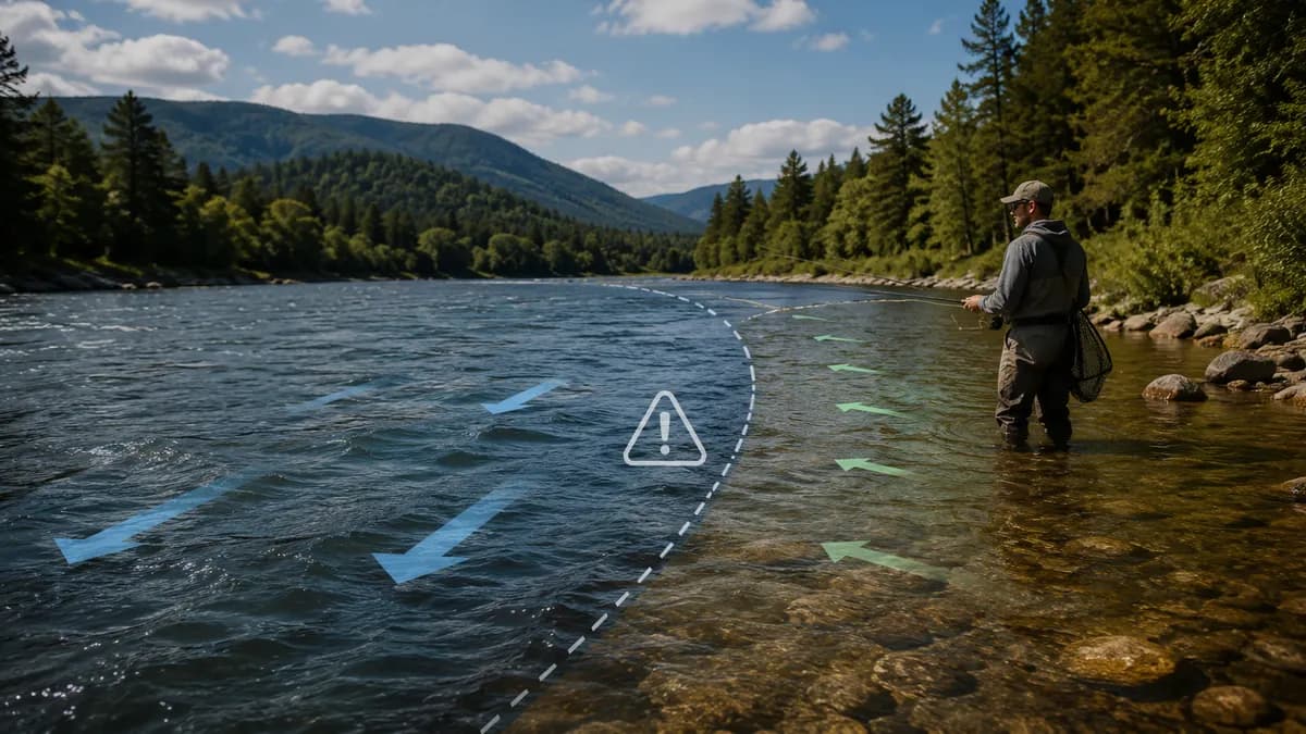
Plenty of good fishing happens in water you should not stand in. High, stained flow can push bait to the banks. A tailwater can fish through a generation pulse that would sweep a wader off their feet. The reverse is also true: a skinny, clear river can be easy to cross and still be a poor fishing window because of temperature or fishing pressure. Mixing those judgments into one “go/don’t go” feeling is how people get hurt — or waste a drive.
Two different questions
StrikeTracks’ river evaluator contracts separate suitability domains. Fishing environmental suitability is not hydrologic safety, wading safety, boating suitability, or shore access. A favorable fishing result must not be read as “safe to wade.” A high-flow caution is not automatically “the fishing is off.” That split is product policy, and it matches how the river actually works.
USGS gage height does not tell you the depth at your boots. It is water-surface height above a local datum, often set below the streambed. Discharge is a volume past the gage, not a wading-depth map of your run. See How to Read a USGS Stream Gauge for Fishing and How River Flow Affects Fishing Conditions.
What StrikeTracks may show — and what it will not claim
Some river pages include historical or advisory flow context related to wading. When that language exists, it is activity-specific context. It does not determine the overall condition rating, and it is not a safety determination. Compact safety copy on river pages is explicit: always assess weather, access, depth, current speed, and your own ability before entering the river.
- Do not treat a Good or Fair fishing rating as a wading green light.
- Do not treat a high-flow fishing opportunity as proof that a crossing is passable.
- Do not use air temperature or water temperature to invent a safe-wading flow. Temperature does not establish hydrologic safety.
- After rain, check the hydrograph and flood products first. Fishing can wait; rising water does not. See Fishing After Rain.
A real river where the two questions diverge
Swift River at West Ware is a small trout tailwater on USGS 01175500. The catalog Good flow band is 30–80 cfs. Trout can still occupy that corridor when discharge is well above the Fair ceiling of 120 cfs — the fish did not leave the valley — but wading a blown tailwater is a different activity. This is not a field report from a named morning. It is the destination’s own scale: tens of cfs are ordinary; hundreds are not a crossing.
The public river notice is: “Preliminary guidance only. Always assess current weather, access, water depth, current speed, and your own ability before entering the river.” StrikeTracks can still show fishing-condition context on that page. It will not convert a fishing rating into a wading certificate. When StrikeTracks Says Wait Even Though the Sky Looks Perfect is the labeled Wait example. Research & Methodology repeats that a rating does not certify wading safety.
Make the decision in the order that keeps you upright
Decide access and personal safety first: current speed, depth you cannot see, debris, cold water, and whether you have an exit. Then decide whether the fishing environment is worth the trip. StrikeTracks can inform the second decision with destination-specific observations. Only you can make the first one, on site, with the water in front of you.
If a page shows both a fishing rating and a wading-related caution, believe the caution as a reason to stay out of the current even if you still want to fish from shore or skip the trip. Decision support is not a substitute for judgment, and it is not a guarantee of anyone’s safety.
Sources and methodology
These are the primary sources this article actually relies on. Linked agencies do not endorse StrikeTracks conclusions.
- USGS 01175500 — Swift River at West Ware, MA — The monitoring location assigned to StrikeTracks destination Swift River at West Ware. Use the station page for current and historical stage and discharge; this article does not invent a live reading.
- StrikeTracks Research & Methodology — Fishing suitability and wading safety remain separate in current river presentation. The compact safety disclaimer is quoted from the accepted public product, not invented for this article.
Related Fishing Insights
- How River Flow Affects Fishing Conditions
Flow changes how a river fishes, how it looks, and how safely you can enter it. This article explains discharge in angler terms and how StrikeTracks uses destination-specific flow context.
- When StrikeTracks Says Wait Even Though the Sky Looks Perfect
Clear weather is not a fishing-condition all-clear. A labeled catalog example on Swift River at West Ware shows why trip guidance can still say Wait or Do Not Go.
- How to Read a USGS Stream Gauge for Fishing
USGS streamgages report water level and often compute discharge. Learn what gage height, flow, and temperature mean for trip planning — and what they never tell you by themselves.